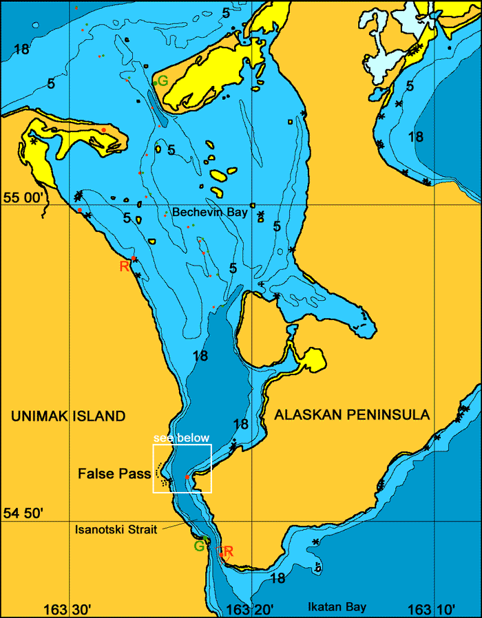
Unimak Island
False Pass.
General. Mainland America finishes at Isanotski Strait. There is a great example of a board walk company fishing town. The company has since ceased all operations except for the fuel wharf. The fuel supply is operated by Peter Pan Fisheries out of King Cove and it would probably pay to call there to check the availability of fuel at this location. This whole area is big on fishing and fuel is available at many locations within a 100 mile radius of here. This pass is used as a shortcut by fishermen heading up into Bristol Bay.
Reported. July 2004 by Fine Tolerance
Charts. NOAA 16520, NOAA 16535.
Approach. Approaching from the south Isanotski Strait is wide and strait although the current flows very strongly through here and you will need to watch the tide when transiting. The approach from the north is through Bechevin Bay which is very shallow. The twisting route through this bay is well marked by many port and starboard marker but due to shifting sands is quite changeable. When sailing north it would pay to check with a local fisherman on whether the channel markers are correct.
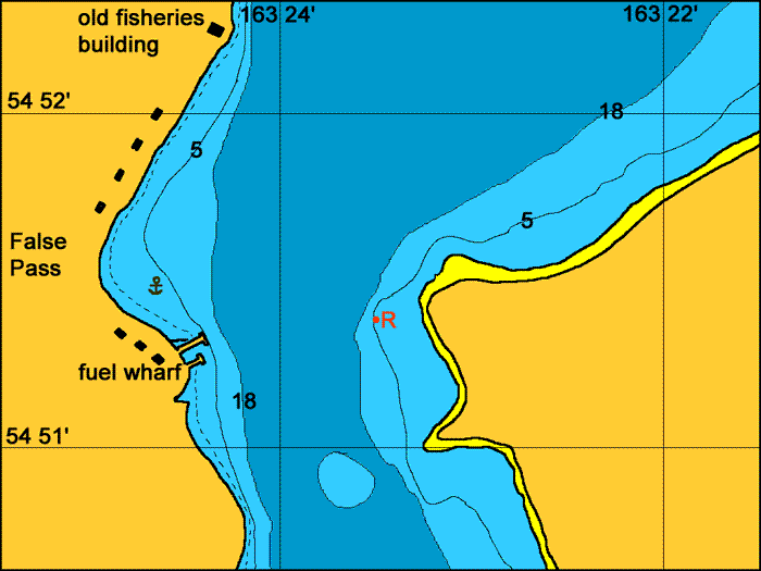
Anchoring. We anchored out of the current directly to the north of the jetties at 54° 51.5'N, 163° 24.4W The bottom here is covered in weed and it took us two tries to get the anchor to dig in. We also spent three nights tied up against the wharf. Both these positions are out of the main current flow.
Points of Interest. The old company part of town is a board walk community and in very good condition and offers many photo opportunities, as does this entire area.
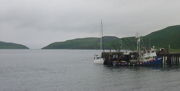
Looking southwards past the fuel dock and into Isanotski Strait.
back to Aleutian Islands main page
back to 'Click On' map of the Aleutian Islands
back to 'Click On' map of the Gulf of
Alaska
back to 'Click On' map of Western
and Arctic Alaska