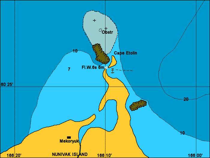
Etolin Anchorage
General. The anchorage is exposed to the northeast but makes for a nice stopover roughly half way between False Pass and Nome. We sheltered here from a strong northwest wind and although the land is low and offers no protection from the wind the seas were flat and we had a comfortable sleep. The currents in Etolin Strait are strong but we did not feel any effect in this bay.
Reported. July 2004 by Fine Tolerance
Charts. NOAA 16006.
Approach. There are no off-shore dangers directly out from this anchorage. There is a large area north of Cape Etolin that has rocks and shallow areas which it is recommended to avoid. There is also a reef a few miles to the south of the anchorage but this is a very easy anchorage to enter. Etolin Strait it is very wide but does have strong tidal currents (2 to 3 kts) passing through it although inside this bay we felt no tide influence.
Anchoring. We went straight in and anchored in 5 meters with a rocky bottom at 60 26'N 166 08.6'W. The flashing light on top of a small tower is clearly visible at night from the anchorage point.
Points of Interest. Mekoryuk Village is about 3 km away. The houses are visible from the anchorage. Mekoryuk is one of only two villages on the Island.
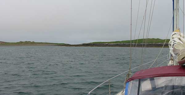
Looking from the anchorage towards the light which you can just see to
the left of centre in this photo.
back to Alaska main page
back to 'Click On' map of Western
and Arctic Alaska