Foggy Bay
Inner Foggy Bay anchorage.
General. This is a handy anchorage half way between Prince Rupert and Ketchikan and a safe waiting place if the weather is bad for a crossing of Dixon Entrance. It is also one of the prettiest anchorages we have stayed at. There is a Fish and Games Warden cabin which is manned in the summer at the northern end of the anchorage. We did sight a black bear with two cubs walking the shore of the protecting island so be careful when venturing ashore.
Reported. October 2003 by Fine Tolerance
Charts. NOAA 17434,
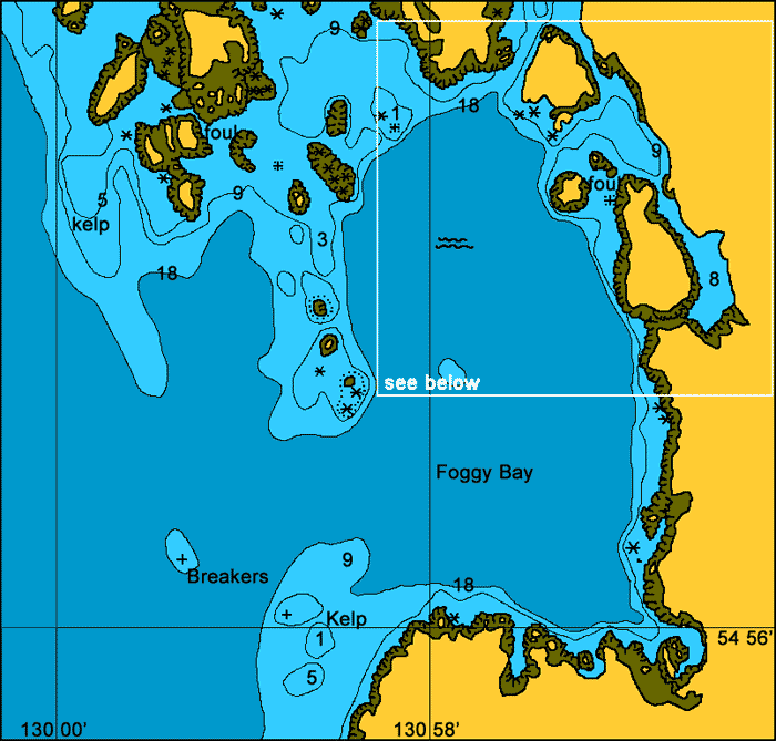
Approach. There are many rocks in this area as can be seen by the mud map above. The southern approach to Foggy Bay has underwater rocks up to 0.6 nm out from Foggy Point while the northern approach has underwater and above water rocks up to 0.7nm out from the De Long Islands. While there is plenty of room you do need to be alert. The entrance is hard to pick up until you are close. When entering the inner anchorage be sure to give the reef and rocks to your starboard a wide berth. The narrow final approach has plenty of depth. Just keep a mid channel course. The reef to the south end of the protecting inland is covered at high tide and should not be attempted by anything else but a canoe.
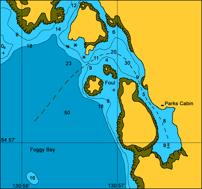
Anchoring. There is plenty of room in this anchorage and as far as we could discover there is good holding mud throughout the entire bay. We anchored at the south end of the bay at 54 56.9'N 130 56.4'W in 9m on mud.
Points of Interest. This is a truly beautiful anchorage and fully protected from all winds.

The final entrance into the anchorage. This is taken from the inside
looking out.
back to Alaska main page
back to 'Click On' map of South East
Alaska