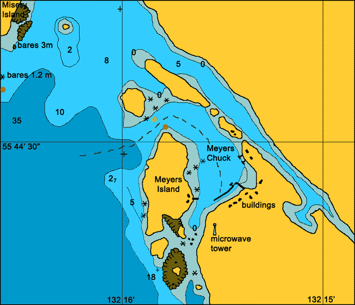
Meyers Chuck
General. This is a pretty harbour with a narrow entrance to the east of Clarence Strait, 35 miles north of Ketchikan.
Reported. October 2003 by Fine Tolerance
Charts. NOAA 17423.
Approach. There is a reef protruding south from Misery Island and one that protrudes out from Meyers Island that need to be kept an eye on. This is a narrow entrance that at first appears to be a dead end but suddenly turns to the right to open up into Meyers Chuck. At the entrance there is a light on the north end of Meyers Island and an buoy that marks the reef off the small islands to the north of the channel. Enter between these two markers and keep mid channel when making the turn to port. Once inside there is plenty of room.
Anchoring. There is a state run dock here which we tied up to. The pilot book states that anchorage can be taken in the narrow arm to the north east of the chuck if the float is full.
Points of Interest. We loved the sound of this name and it is a handy half way stopover between Ketchikan and Wrangell. There is a public telephone at the top of the walkway. There is no fuel available here.
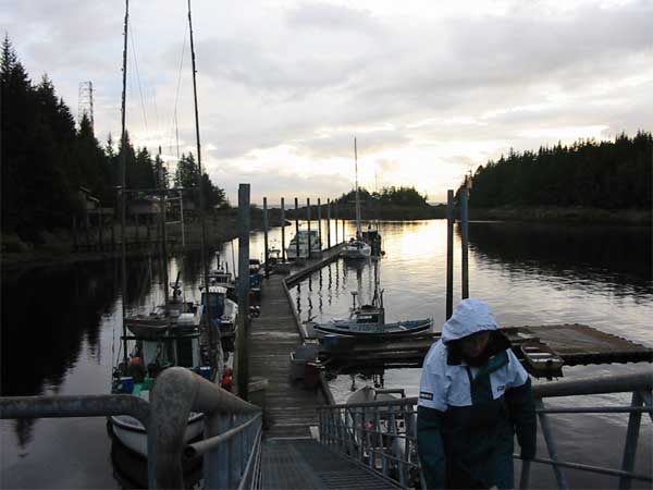
The public floats at Meyers Chuck.
back to Alaska main page
back to 'Click On' map of South East
Alaska