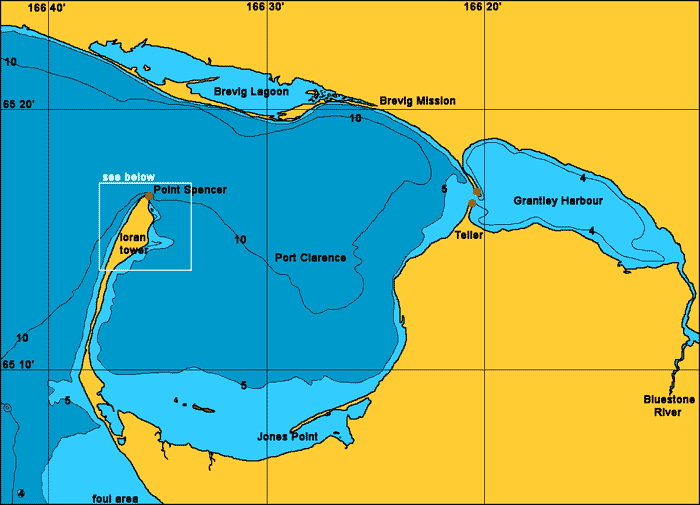
Port Clarence
General. There are many possible anchorages in Port Clarence which is the only good natural harbour in Western Alaska. The bay is formed by a large sand spit near the end of which is built a loran station with a 420 meter high tower. There is a road between Teller and Nome.
Reported. July 2004 by Fine Tolerance
Charts. NOAA 16204
Approach. There are no off-shore dangers here. There is a light on the end of the spit. There is also plenty of lights at the loran station and aviation warning lights on the tower.

Anchoring. We went just inside the the end of the spit and tucked in close behind to shelter from a southerly wind and dropped anchor at 65 16.4'N 166 50.6W in 6 meters of thick good holding mud. There are some below water reefs close in to shore.
Points of Interest. While here a dinghy filled with locals from Brevig Mission on the other side of the bay stopped on their way to the Loran station to sell some crafts. They had on offer the best looking scrimshawed walrus tusk we have ever seen, before or since.

Looking from the anchorage over to the loran station.
back to Alaska main page
back to 'Click On' map of Western
and Arctic Alaska