Portage Bay
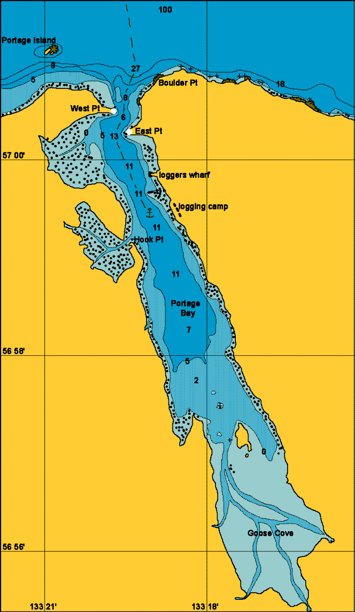
General. This is a large bay capable of taking many vessels. Situated on the south side of Frederick Sound on Kupreanof Island it makes for a nice stopover just 25 nm north of Petersburg.
Reported. October 2003 by Fine Tolerance
Charts. NOAA 17367, NOAA 17368.
Approach. There are strong currents with swirls at the entrance here and it is best entered near or at slack water. The entrance is easily seen from out in Frederick Sound by the two Portage Islands which are slightly to the west of the entrance. There is a tower with a green daymark and light on East Point. West Point has a red day beacon. Keep roughly to the track as shown on the mud map below and you should have no problems.
Anchoring. Keep a mid channel course until past the logging wharf on the east shore. We anchored at 56 58.9N 133 18.9W in 9 meters, good holding mud.
Points of Interest. The activities of the logging camp retreating for the winter kept us occupied. After all, doesn't take much to keep us occupied! It looked a nice bay to explore but we were on a mission and did not put the dinghy in the water.

This photo was taken when passing West Point and looking ahead into Portage
Bay.
The marker on East Point is clearly visible in this photo.
back to Alaska main page
back to 'Click On' map of
South East Alaska